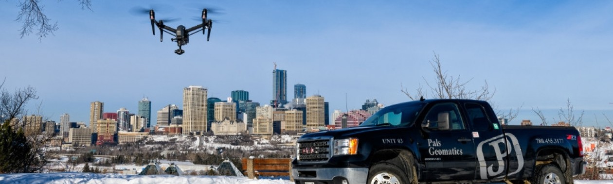
Drone Services
Pals Geomatics offers aerial surveying solutions as part of our full-service model. These services allow for increased efficiency and quality of our deliverables, as well as innovative new product offerings. Pals Geomatics is Federally certified and insured to operate Remotely Piloted Aircraft Systems (RPAS), more commonly known as drones, throughout Alberta. We are fully equipped with three licensed RPAS pilots and two aircraft to collect aerial data, in addition to fully equipped survey crews for setting ground control.
Contact us to discuss your aerial data needs at edmonton@palsgeomatics.com or 1-800-263-0305
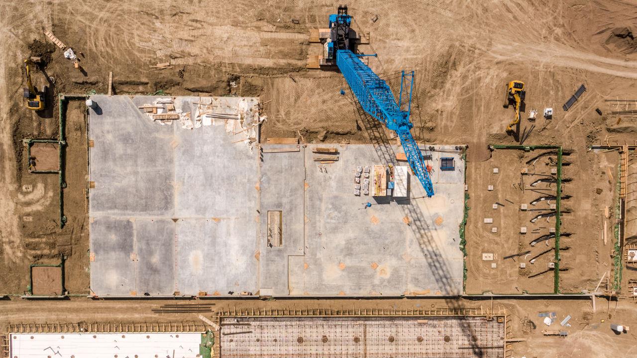
Ortho images and videos of construction sites can be valuable tools for:
- Progress reporting
- Site documentation
- Safety hazard identification
- Planning purposes
Utilizing our drones we can generate highly detailed 3D surface models. Using these models, we can calculate volumes of material moved or placed with improved detail and accuracy over conventional methods and in a fraction of the time. Drone generated 3D models will create 3D points at centimeter spacing.
Our unique processing abilities allow us to provide aerial data at survey grade accuracy repeatably and efficiently. Each survey is accompanied by a quality report specific to that survey. Typical accuracy results are shown below:
- Vertical accuracy on clear surfaces such as gravel, asphalt, or cultivated fields is 3cm
- Vertical accuracy on agricultural fields with stubble is 3-5cm
- Horizontal accuracy is 1 to 2 cm
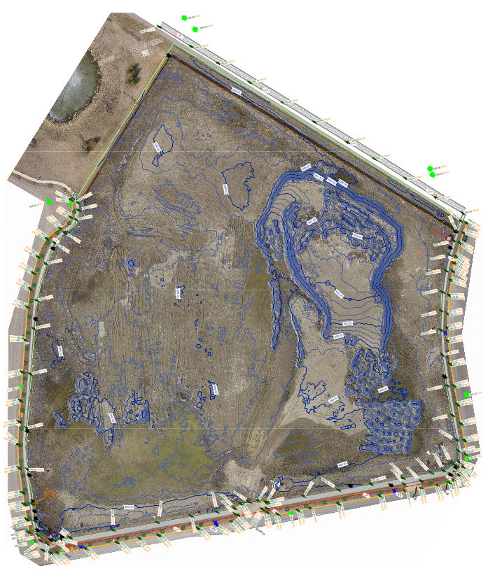
Elevation Contours
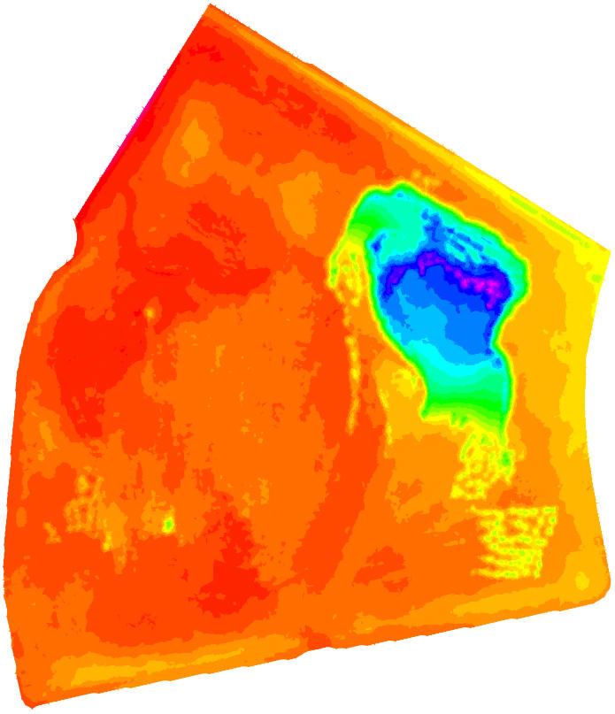
Elevation Heatmap
Our drone processes will allow you to take your site design and planning to the next level. Incorporating high resolution orthophotos into your topographic survey allows you to visualize the entire site, enhancing traditional topographic plans. Every orthophoto comes with a hyperlink to easily view the orthophoto and 3D point cloud on a web-based viewer. Orthophotos can be geo-referenced (located at ‘real world’) and are created at a uniform scale to allow accurate measurement.
Our unique processing abilities allows us to provide aerial data at survey grade accuracy repeatably and efficiently.
- Vertical accuracy on clear surfaces such as gravel, asphalt, or cultivated fields is 3cm
- Vertical accuracy on agricultural fields with stubble is 3-5cm
- Horizontal accuracy is 1 to 2 cm
Mayfair Orthophoto hosted on Pix4D Viewer
Mayfair Pointcloud hosted on Pix4D Viewer
Use one of our drone platforms to obtain the aerial views that you need to market residential properties, land development projects, and commercial buildings.
We can provide:
- 4K video
- High resolution still images
- Interactive 360-degree panoramic photos
- 3D models
Point Cloud Flyby Video of Royal Mayfair Golf Club
|
10704-176 St. |
Need a Quote? Have a Question?
(780) 455-3177 |
10704-176 St., Edmonton, Alberta T5S 1G7 / P: (780) 455-3177 / F: (780) 451-2047 / Toll Free: 1-800-263-0305 / E: edmonton@palsgeomatics.com
105, 4909A 48 St. Camrose, Alberta T4V 1L7 / P: (780) 781-8372 / F: (780) 451-2047 / Toll Free: 1-800-263-0305 / E: camrose@palsgeomatics.com
Website & Hosting By Pixel Army